

Published: 2026-07-30 | Author: Karl Huang
I first understood Xinjiang’s weather the hard way. In April 2022 I met a client, Tom, at Urumqi Diwopu International Airport at 6:40 a.m. The forecast said 11°C, so I wore a light jacket. By the time our 9:15 a.m. flight to Kashgar touched down, the cabin crew announced a ground temperature of 3°C and a 40 km/h wind that nearly took my hat. Since then I have spent eight springs, summers, autumns, and winters documenting conditions across the region for the Xinjiang Itinerary project. This Xinjiang Weather Guide pulls those field notes into one practical reference so you can pack and plan with real numbers, not tourist-brochure promises.
Quick Reference
| Region | Best Time to Visit | Summer High (°C) | Winter Low (°C) |
|---|---|---|---|
| Northern Xinjiang (Kanas, Altay, Hemu) | September to October | 22 | -28 |
| Turpan Basin | April to May, September to October | 45 | -18 |
| Kashgar & Pamir Plateau (South) | May to October | 32 | -12 |
| Urumqi & Ili Valley | May to September | 30 | -20 |
| Taklamakan Desert | October to April | 40 | -15 |
What the Weather Actually Feels Like
The single fact every traveler needs: Xinjiang is huge and dry, and that combination produces some of the most extreme temperature swings on the planet. On a July trip through the Turpan Basin I recorded 43°C at 3 p.m. near the Flaming Mountains, then shivered at 19°C the same evening after the sun dropped behind the dunes. In the north the swings run the other way. During a September stay in Hemu Village the midday sun felt like early summer at 21°C, but the guesthouse owner, a woman named Gulnar, knocked on my door at 6 a.m. to tell me it had hit -4°C and the wooden walkways were slick with frost.
Wind is the other character. The Dabancheng corridor between Urumqi and Turpan is famous for gusts above 100 km/h, and I have seen a roadside noodle stand blow over in seconds. Spring, especially April and May, is when dust storms are most likely. On one drive from Korla to Kuqa a wall of orange dust reduced visibility to about 200 meters, and our driver pulled off the highway for 40 minutes until it passed. None of this is dangerous if you respect it, but it does mean your packing list has to cover three seasons at once.
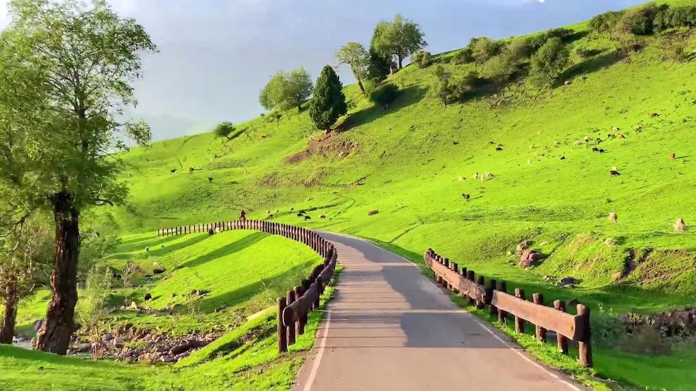
Rain is rare almost everywhere. Urumqi averages roughly 290 mm of precipitation a year, less than London gets in a wet month. The mountain fringes, like the Tianshan above Sayram Lake, catch more moisture and turn green in June. The deserts get almost none. I carried an umbrella for two full weeks on my first visit and never opened it once.
How to Get There
Most international visitors arrive via Urumqi Diwopu International Airport (IATA: URC), which connects to Beijing, Shanghai, Guangzhou, and several Central Asian capitals. A standard economy fare from Beijing ran about 1,450 RMB on the spring dates I booked in 2023. From Urumqi you reach the weather zones by air or by the well-developed rail network: the high-speed line to Turpan takes 50 minutes, and an overnight sleeper train to Kashgar costs between 320 and 680 RMB depending on the berth.
The practical point for a weather guide is this: do not trust a single forecast app for the whole region. Conditions in Kashgar and Kanas can differ by 25°C on the same day. I keep two apps open, one international and one Chinese (the local Weather China service is more accurate for remote counties), and I check the specific county, not the province, before any mountain or desert drive. If you want the bigger planning picture, our Best Time to Visit Xinjiang Guide breaks the calendar down month by month.
Best Time to Visit
Spring (March to May). The Ili Valley explodes with apricot blossoms in late March, and I timed a 2024 trip to Xinyuan for the 28th of that month when the orchards were at peak. Daytime highs reach 18 to 24°C. The downside is wind and the occasional dust storm, plus snow can linger in the north until mid-April.
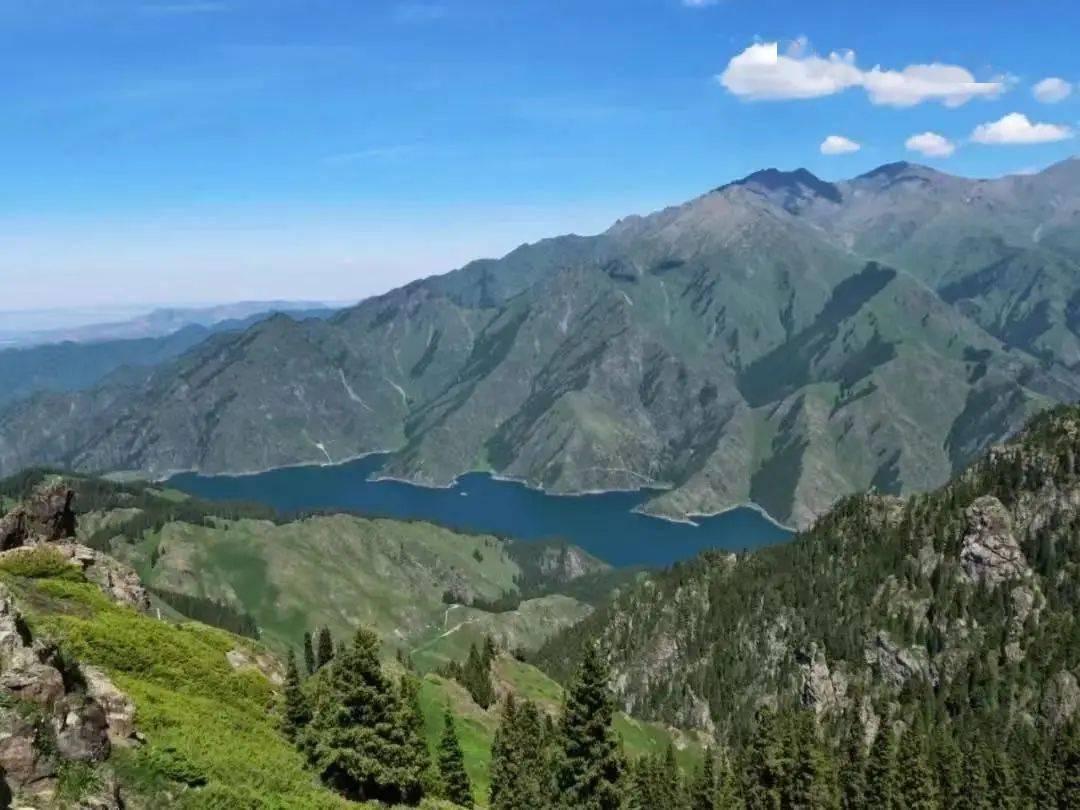
Summer (June to August). This is peak season for a reason. Grasslands in Nalati and Bayinbuluke are at their greenest, and mountain lakes like Sayram sit under clear blue skies. Urumqi stays a pleasant 28 to 30°C. The Turpan Basin, though, is brutal, regularly above 40°C, so plan air-conditioned midday breaks. If you visit in summer, our Xinjiang Summer Itinerary maps a route that avoids the worst heat.
Autumn (September to October). My personal favorite and the one I recommend most. The Kanas forests turn gold, the skies are stable, and the crowds thin after the National Day holiday ends around October 7. Daytime highs of 15 to 22°C in the north feel crisp and clean. This is also the best window for the Taklamakan’s edge and for desert highways before winter closes mountain passes.
Winter (November to February). Very cold in the north, where Kanas road access is limited and some guesthouses close. But the south stays workable: Kashgar sits around freezing by day and the Pamir Highway is open on clear days. Winter brings the Ice and Snow Festival in Urumqi and near-empty attractions. For the autumn alternative, see our Xinjiang Autumn Itinerary.
My recommendation: travel in the last two weeks of September or the first week of October. You get stable weather, the best foliage, and you dodge both the summer heat and the post-holiday rush.
Where to Stay
Budget. Hostels and local guesthouses run 90 to 160 RMB a night. In Hemu and Baihaba the wooden cabins are basic but warm, with thick quilts that handle the cold well. Book directly at the desk in smaller villages where online platforms lag.
Mid-range. Comfortable business hotels in Urumqi, Kashgar, and Yining cost 280 to 480 RMB. I regularly use the Hoi Tak Hotel in Urumqi (around 420 RMB) for its reliable heating and central location near the bazaar.
Upper. International-standard properties like the Kashgar Radisson or boutique Silk Road lodges run 700 to 1,400 RMB. In winter, upper-tier hotels are the safe choice because their heating and generators are dependable when temperatures plunge.
Food
Xinjiang’s food is built for its climate: calorie-dense, warming, and built around lamb and wheat. A bowl of laghman hand-pulled noodles with beef ran me 28 RMB at a corner spot in Kashgar. Da pan ji, the famous big-plate chicken with potatoes and belt noodles, feeds two for about 68 RMB. For breakfast I lean on samsa baked in tandoor ovens, 6 to 10 RMB each, eaten hot against a cold morning.
In summer the melons are unbeatable. A Hami melon from a roadside stall costs 3 to 5 RMB a kilo and is sweeter than anything I have found in a Western supermarket. Winter calls for shou zhua fan (hand-grabbed rice with mutton and carrots), a steaming plate for roughly 35 RMB that warms you fast. Tea, served constantly and free in most restaurants, is your friend against the dryness.
Practical Tips
- Pack layers even in summer. A light down jacket earned its place in my bag on every one of my eight trips, including July.
- Carry lip balm and a refillable water bottle. The humidity often drops below 30 percent, and dehydration sneaks up on you.
- Check the county-level forecast, not the regional one, before any drive over a mountain pass or into the desert.
- Sunscreen is non-negotiable. At elevation on the Pamir Plateau the UV index hits extreme levels, and I burned in late September despite cool air.
- Time outdoor sightseeing for early morning and late afternoon. Midday in the basins is the hottest, harshest part of the day.
- Book northbound transport before late October. Duku Highway and some Kanas access roads close with the first heavy snow.
Sample Itinerary
This seven-day loop targets stable early-October weather:
Day 1. Arrive Urumqi midday, 22°C, walk the International Bazaar, overnight city hotel.
Day 2. Morning train to Turpan (50 min), visit Jiaohe Ruins at 26°C, evening return.
Day 3. Fly to Kashgar, clear skies, 19°C, explore the Old City at golden hour.
Day 4. Drive the Karakoram Highway toward White Sand Lake, crisp 12°C mountain air.
Day 5. Return to Kashgar, Sunday livestock market if timing allows, slow afternoon.
Day 6. Fly to Urumqi, then transfer north toward the Ili Valley, autumn colors beginning.
Day 7. Sayram Lake at 14°C under blue sky, then fly out from Yining.
FAQ
What is the coldest month in Xinjiang?
January is the coldest. Northern towns like Altay and Fuyun regularly fall below -25°C, and I recorded -28°C on a January night in Burqin.
Does it rain a lot in Xinjiang?
No. Most of the region is arid, with annual totals under 300 mm. The mountain fringes get more, but the deserts and basins stay dry for months at a time.
How big are the daily temperature swings?
Large. A 15 to 20°C difference between afternoon high and pre-dawn low is normal, and in the Turpan Basin the gap can reach 25°C in a single day.
When does it snow in Xinjiang?
The first snow usually arrives in the north by late October or early November. Mountain passes can see flurries in September. The south gets lighter, later snow, often not until December.
Is Xinjiang dry or humid?
Overwhelmingly dry. Low humidity means cold feels less biting than the number suggests, but it also means you need to drink more water than feels natural.
Which month has the best weather overall?
Late September to early October offers the best balance: stable skies, mild days, gold foliage, and manageable crowds once the National Day holiday ends.
Disclaimer
The temperatures, prices, and schedules in this guide come from my personal trips and publicly available records, but they change. Park fees, train fares, hotel rates, and even road opening dates shift from year to year, and extreme weather can close passes without notice. Always confirm current conditions with official sources, your hotel, and local transport operators before you travel. This article is practical guidance, not a guarantee of weather or availability.