

Published: 2026-07-21 | Author: Karl Huang
Last June I drove the northern loop with two photographers from Shanghai. We paid 8,400 RMB for a seven-day 4WD with driver, left Urumqi at 6:40 a.m., and reached the Duku Highway gate at Dushanzi before the 9:00 crowd built up. That trip is why I tell people the Best Time for North Xinjiang Itinerary is not one month but a window you choose by what you came to see. Spring snow, summer green, and October gold each open different roads and different moods. This guide is the season-by-season plan I use when I build northern routes for real travelers.
Quick Reference
| Stop | Entry fee | Best time | Role on the route |
|---|---|---|---|
| Urumqi | None (gateway) | Year-round | Flight and train hub where most routes start |
| Kanas Lake | 195 RMB (with shuttle) | Sep 20 – Oct 5 | Headline forest lake in the Altai north |
| Hemu Village | 102 RMB (Kanas pass) | Late Sep – early Oct | Wooden Tuva village, sunrise viewpoint |
| Duku Highway | Free (toll sections) | Jun 1 – Sep 30 | Mountain road linking north and south Xinjiang |
| Nalati Grassland | 95 RMB | Jun – Aug | Alpine pasture, yurt stays |
| Sayram Lake | 70 RMB | Jun – Jul | High alpine lake near the Kazakh border |
The first time I ran this loop, I made the mistake everyone makes. I booked the flights for early May, imagining green valleys, and landed to a closed Duku Highway and a Kanas still under snow. The road crews did not clear the passes until the first week of June that year. My group sat in Urumqi for two extra nights and paid 600 RMB more for the rebooked northern leg. That wasted week is the reason I now treat the Best Time for North Xinjiang Itinerary as a planning problem, not a calendar guess.
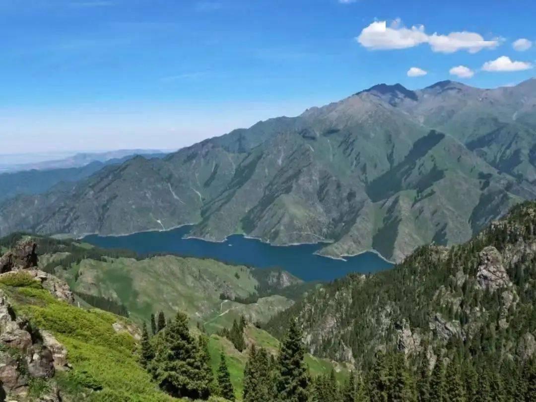
North Xinjiang means the Altai mountains in the far north and the Tianshan spine that runs through the middle. They do not share a season. The Altai (Kanas, Hemu, Baihaba) peaks in early October when the larch turns gold. The Tianshan grasslands (Nalati, Bayinbuluke) peak in July and August when the grass is tall and the weather is warm. The Duku Highway, the thread that ties them together, opens only from roughly June to September. Pick your month and the route builds itself. When people ask about the North Xinjiang Itinerary Xinjiang travelers actually book, they usually mean the Altai-plus-Tianshan loop, and the best time to visit North Xinjiang Itinerary really comes down to two short windows.
How to Get There
Most travelers fly into Urumqi Diwopu International Airport. A direct flight from Beijing runs about 4 hours and costs 1,600–2,400 RMB depending on season; from Shanghai it is closer to 5.5 hours and 1,900–2,800 RMB. From the airport, the north-bound route splits two ways.
Option one is the train to Beitun or Altay, then a 3-hour transfer up to Kanas. A soft-sleeper berth from Urumqi to Beitun costs around 320 RMB and saves a full day of driving. Option two is to rent a car or hire a driver in Urumqi and run the loop clockwise: Urumqi → Dushanzi → Duku Highway → Bayinbuluke → Yining → Sayram Lake → back across to Urumqi. That clockwise run is what I used for the Shanghai photographers, and it let us catch the Duku before the midday traffic.
If you want a ready-made skeleton to Hang the dates on, my North Xinjiang Itinerary Guide lays out the three standard loops with drive times. Read it before you lock flights, because the road status changes which loop is even possible in a given month.
Best Time to Visit: the Best Time for North Xinjiang Itinerary
Spring (April – mid May) is the quietest and the riskiest. Roads at elevation are often still closed, hotels in Kanas run on reduced staff, and the landscape is more brown than green. I only send people then if they specifically want empty trails and low prices.
Early summer (June) is the opening act. The Duku Highway usually clears in the first days of June. Grass starts greening, crowds are lighter than July, and prices sit about 15% below peak. This is my favorite month for the clockwise drive because you get open roads without the July crush.
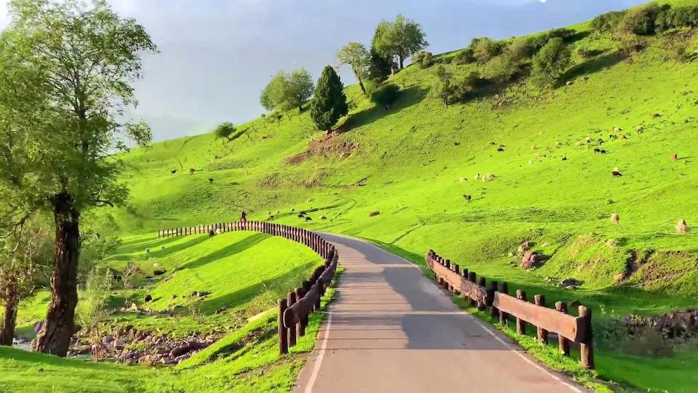
Mid summer (July – August) is peak. Nalati and Bayinbuluke are at their greenest,Sayram Lake is calm and blue, and every shuttle runs full schedule. The trade-off is heat in the Turpan-side lowlands and the highest hotel rates of the year. Book stays 3–4 weeks out or you will pay walk-up prices.
Autumn (September 10 – October 5) is the headline season for the Altai. The larches around Kanas and Hemu go gold, the light is low and warm, and the photo crowds thin after the National Day holiday ends around October 7. After October 10, guesthouses in Hemu start boarding up for winter.
Winter (November – March) closes most of the north. Kanas stays open as a snow destination but requires chain driving and a local guide, and the Duku is shut. I recommend it only to travelers who have done the north before and want the quiet version.
For the Best Time for North Xinjiang Itinerary, my clear recommendation is two windows. If your goal is the famous golden Kanas, target September 20 to October 5. If your goal is green grasslands and the full Duku drive with manageable crowds, target the first three weeks of June. Those two windows cover 90% of what people actually want from a northern route.
Where to Stay
Budget travelers do well in Urumqi and the larger towns. A clean hostel bunk or budget hotel room in Urumqi runs 150–220 RMB per night. Inside Kanas scenic area, the cheaper options are the tourist-cantonment dorm beds at 180–260 RMB, but they fill fast in October.
Mid-range is where most of my groups land. A solid three-star in Yining or Beitun costs 320–480 RMB. Inside Kanas, the standard wooden-cabin hotels run 480–700 RMB in peak season and drop to 350 RMB in June.
Upper-end stays are limited but real. The lakeside lodges near Kanas command 1,200–1,800 RMB in October, and a few boutique yurt camps on Nalati charge 900–1,400 RMB with meals included. Book these six weeks ahead for the October window.
Food
Northern Xinjiang eats lean Kazakh and Uyghur. In Hemu I paid 45 RMB for a plate of laghman (hand-pulled noodles) with mutton, and 30 RMB for fried pierogi-style manty at a family kitchen. Urumqi’s International Grand Bazaar has skewer stalls where ten lamb sticks run 40–50 RMB.
In Yining, the Russian-influenced bread and smoked fish are worth a stop; a loaf of cirika bread is about 12 RMB. On the grassland drives, roadside yurts sell fresh kumis (fermented mare’s milk) by the bowl for 15 RMB. None of this is fancy, but it is filling after a long day on mountain roads. If you want the wider eating picture, my Xinjiang Self-Driving Guide has a full road-food section with stop-by-stop towns.
Practical Tips
- Check the Duku Highway status the morning you plan to drive it. Snow can close the northern pass for a day even in June, and the official notice posts on WeChat are the fastest source.
- Carry cash in small bills. Hemu and Baihaba have patchy card signal, and the entry gates sometimes only take cash for the shuttle top-up.
- Pack for two seasons. At Kanas in early October the dawn temperature hits minus 3 Celsius while the midday sun pushes 18. Layers beat a heavy coat.
- Book the October Kanas lodges early. The golden window is short and the room count inside the scenic area is fixed, so walk-up prices double.
- Start drives before 8:00 a.m. The shuttle queues at Kanas and the Duku gate both swell after nine, and an early start buys you empty viewpoints.
Sample Itinerary
This is the June version I ran with the Shanghai group, trimmed to a timeline:
- Day 1: Fly into Urumqi (arrive 2:00 p.m.), restock supplies, overnight Urumqi.
- Day 2: Depart 6:40 a.m., reach Dushanzi, enter Duku Highway, overnight Bayinbuluke (440 km).
- Day 3: Bayinbuluke grassland morning, drive to Yining, overnight Yining (260 km).
- Day 4: Sayram Lake at sunrise, loop the east shore, overnight near the lake (90 km).
- Day 5: Drive to Beitun, transfer to Kanas, afternoon lakeside walk, overnight Kanas (380 km).
- Day 6: Hemu Village sunrise viewpoint, wooden-house lunch, overnight Hemu (70 km).
- Day 7: Return to Urumqi via Altay flight or long drive, end of loop.
For the October golden version, swap Days 2–4 for a direct Urumqi → Beitun → Kanas → Hemu run and give Kanas two full days. My North Xinjiang Itinerary Tips piece covers the photo-timing details for that window, including the exact 7:20 a.m. light at the Hemu bridge.
FAQ
Is June or October better for a first trip?
It depends on the goal, and the Best Time for North Xinjiang Itinerary depends on whether you want grasslands or gold. June gives you the open Duku Highway and green grasslands with lighter crowds. October gives you the gold Kanas that most photos show, but the Duku may already be closed, so you would fly or train the Altai leg instead.
How many days do I need for the north?
Seven days covers the core loop if you fly the Altai leg. Ten days lets you drive the full clockwise route and add Sayram Lake properly. Anything under six days means cutting either Kanas or the grasslands.
Do I need a permit for North Xinjiang?
Foreign travelers need the standard Xinjiang travel paperwork and should check current rules before booking. My Xinjiang Visa and Permit Guide tracks what is required and where to apply. Rules shift, so confirm close to your date.
Can I self-drive the Duku Highway?
Yes, in a rented or owned vehicle, but only when it is open and only with a driver used to mountain passes. Large RVs are restricted on sections, and the weather can turn fast at the 3,400-meter summit.
What should I pack for October?
A warm layer for sub-zero dawns, a sun hat for 18-degree middays, and a power bank because cold drains phone batteries fast at the viewpoints.
Disclaimer
Prices, road opening dates, permit rules, and entry fees listed above reflect what I observed on trips through 2024 and 2025 and can change without notice. The Duku Highway opening in particular moves with snow conditions year to year. Always verify current fees and access rules with the official scenic-area offices or your embassy’s travel advisories before you commit money to flights and lodging.