

Published: 2026-07-28 | Author: Karl Huang
Our Xinjiang Altitude Sickness Guide exists because I learned the hard way. In October 2023 I drove the G314 from Kashgar to Tashkurgan with two clients from Shanghai. We left Kashgar at 1,290 meters and reached Tashkurgan at 3,090 meters in under six hours. By the time we parked outside the Pamir Hotel at 4 p.m., one client had a pounding headache and could not keep down the laghman we ordered. That trip taught me more about elevation than any brochure ever could.
About This Xinjiang Altitude Sickness Guide
Most visitors picture Xinjiang as deserts and night markets. The surprise is how much of the region sits high. The Pamir Plateau in the south and the Tianshan passes in the north push well past 2,500 meters, the point where acute mountain sickness (AMS) usually begins. This guide pulls together what I tell every client before they head south: where the thin air actually bites, how to plan an ascent that your body can handle, and what to do when things go wrong. I have spent eight seasons on these roads, and the pattern is always the same. People rush, they skip the acclimatization night in Kashgar, and they pay for it at Karakul Lake. Keep this Xinjiang Altitude Sickness Guide open while you plan. Most Xinjiang travel guide books describe the views but skip the medical side, and that gap is where trips go sideways.
Quick Reference
| Location | Elevation | Role on a trip | Best time to ascend |
|---|---|---|---|
| Kashgar | 1,290 m | Main launch point for the south | Any time; sleep here 1–2 nights first |
| Karakul Lake | 3,600 m | Overnight stop on the Karakoram Highway | May–Oct; stay only one night |
| Tashkurgan | 3,090 m | Border town and permit checkpoint | May–Oct |
| Khunjerab Pass | 4,733 m | Highest paved border crossing in the world | Jun–Sep only |
| Duku Highway summit | ~3,400 m | Mountain pass across the Tianshan | Jun–Sep; closed in winter |
| Bayinbuluke | ~2,500 m | Grassland and Swan Lake | Jun–Sep |
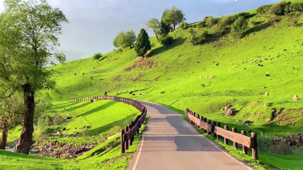
The numbers above are the ones that matter for your body. Below 2,500 meters most healthy travellers feel nothing. Between 2,500 and 3,500 meters mild symptoms show up in perhaps a third of visitors. Above 4,000 meters the risk climbs sharply, and the Khunjerab Pass at 4,733 meters is no place to linger if you feel unwell.
How to Get There
Almost every high-altitude route in Xinjiang starts from a low city. For the Pamir Plateau, fly from Urumqi to Kashgar (about two hours, roughly ¥900 one way in shoulder season) and treat the city as your acclimatization base. From Kashgar the G314 Karakoram Highway runs roughly 290 km to Tashkurgan. A private car with driver costs around ¥1,200–1,600 for the day; the public shuttle is cheaper at about ¥80–100 per seat but leaves you less control over stops.
Tashkurgan sits inside a border control zone, so you need a border permit (边境管理区通行证). In Kashgar you apply at the entry-exit office with your passport; the permit is free and usually ready the same morning if you arrive before 10 a.m. Details change, so I keep the current steps in our Xinjiang Border Travel Permit Guide. Without that slip of paper, police will turn you back at the checkpoint 60 km out of town.
The other famous high road is the Duku Highway, which cuts from Dushanzi to Kuqa across the Tianshan. Its summit near the Hashilegend area touches about 3,400 meters. Most people drive it in a single day and feel only mild breathlessness, but if you plan to sleep at the top or combine it with a Bayinbuluke stay, give yourself a low-elevation night first.
Best Time to Visit (per this Xinjiang Altitude Sickness Guide)
Altitude sickness is driven by elevation, not calendar, but the seasons still shape your risk because they change road access and weather. The common question, best time to visit Xinjiang altitude sickness, really comes down to which high passes are open and when.
Spring (March–May). The Pamir is windy and still cold at night, with pass snow lingering into May. Roads are open but the Karakul Lakeside can drop below freezing. Good for fewer crowds, less good for comfort.
Summer (June–August). This is the safest window. The Khunjerab Pass is open, grasslands are green, and daytime temperatures at altitude stay mild. The catch is afternoon thunderstorms on the plateau and the heaviest domestic tourist flow. Start drives early to avoid both.
Autumn (September–October). My favorite. Skies are clear, the light is clean, and the heat of summer is gone. Nights get cold fast above 3,000 meters, so pack a real jacket. By late October the first snow can close high sections.
Winter (November–February). The Duku Highway shuts. Tashkurgan stays reachable but is harsh, with sub-zero nights and limited services. Only attempt it if you have winter driving experience and a guide.
My recommendation: aim for late September. You get stable weather, open passes, and the lowest chance of being caught by a sudden storm while your oxygen saturation is already low.
Where to Stay
Sleeping low is the single best defense, so plan your beds with elevation in mind.
Budget. In Kashgar a decent hostel or guesthouse runs ¥60–120 a night, and you should spend at least one night there before going up. In Tashkurgan basic guesthouses cost ¥150–250, often with thin walls and no heating in the shoulder season.
Mid-range. The Pamir Hotel in Tashkurgan runs about ¥350–500 and offers oxygen-equipped rooms, which I now book by default for clients over 50. In Urumqi, comfortable mid hotels sit around ¥300–450 and give you a clean low-elevation recovery night before a flight south.
Upper. Urumqi has several international-standard hotels with medical-grade oxygen rooms at ¥700–1,200 a night. If a traveller already feels rough, I pull them back to Urumqi rather than pushing on to the plateau. Descending to sleep is not a failure; it is the plan.
Food
What you eat at altitude affects how you feel. The goal is steady energy, hydration, and nothing that dehydrates you.
- Laghman (hand-pulled noodles). Around ¥25–35 a bowl, easy to digest and filling after a long drive.
- Manty (steamed dumplings). About ¥30 a plate, a safe protein hit if meat smells turn your stomach.
- Yak or lamb stew. ¥40–50, warm and salty, which helps with both heat and salt loss.
- Ginger tea. ¥8–12 a cup at most guesthouses; settles a queasy stomach without caffeine.
- Bottled water. ¥3 a liter; aim for three to four liters a day, more if you are walking.
- Coca-Cola or sweet tea. A quick sugar lift when appetite fails, but keep it modest.
Skip the alcohol on day one at altitude. A glass of baijiu that feels fine in Kashgar can wreck your night at 3,000 meters. Locals swear by raw garlic for the blood, and while the science is thin, a little in your food will not hurt.
Practical Tips
The steps that follow are the core of this Xinjiang Altitude Sickness Guide, the same seven points I repeat to every client in Kashgar before they head south.
- Sleep low before you go high. Spend one or two nights in Kashgar at 1,290 m before driving south.
- Climb high, sleep low. Reach Karakul Lake at 3,600 m for a walk, then drop to Tashkurgan to sleep.
- Drink three to four liters of water daily. Dehydration mimics and worsens AMS symptoms.
- Talk to a doctor about acetazolamide (Diamox). Many travellers start 125–250 mg twice a day a day before ascent; it is prescription, not a casual choice.
- Carry two oxygen canisters. They sell in Kashgar pharmacies for ¥20–30 each and buy you time to descend.
- Learn the danger signs. confusion, loss of balance, a wet cough with pink foam, or breathlessness at rest mean HACE or HAPE. Those are emergencies; get down immediately.
- Keep day one light. No heavy meals, no alcohol, no strenuous hiking until your body adjusts.
Sample Itinerary
This five-day shape has carried dozens of my clients to the Pamir without a serious incident.
Day 1. Fly Urumqi to Kashgar (2 hours, ~¥900). Check in low, walk the old city slowly, drink water, sleep at 1,290 m.
Day 2. Morning: collect your border permit (arrive before 10 a.m.). Afternoon: light stroll, no exertion. Second night in Kashgar to lock in acclimatization.
Day 3. Drive the G314 to Karakul Lake (3,600 m). Short walk by the shore, then continue to Tashkurgan (3,090 m) and sleep there rather than at the lake.
Day 4. Day trip north to the Khunjerab Pass (4,733 m). Stay no more than 30–40 minutes at the top, then return to Tashkurgan to sleep.
Day 5. Drive back to Kashgar and spend the night low. If anyone felt rough up high, this recovery night resolves most mild cases.
FAQ
Do I need to be fit to handle Xinjiang’s altitude?
Fitness helps with stamina but does not prevent AMS. I have seen marathon runners flattened at Karakul Lake. The deciding factor is ascent speed, not gym time.
Can I fly straight to a high place?
There is no commercial airport above 3,000 m in Xinjiang, so you cannot skip the climb by air. The highest you land is around 1,300–1,400 m (Kashgar, Hotan, Kuqa), which is exactly why a Kashgar buffer night works.
Is oxygen available on the plateau?
Yes. Canisters sell in Kashgar and Tashkurgan for ¥20–30, and several Tashkurgan hotels have oxygen rooms. Treat oxygen as a bandage, not a plan; descend if symptoms persist.
What if I get sick on the Duku Highway?
Pull over, use oxygen, and drive down toward Dushanzi or Kuqa, both well below 1,000 m. The highway has ranger posts, and phone coverage is decent along the main stretch. Do not try to sleep at the summit.
Which areas are highest and most risky?
The Pamir Plateau (Tashkurgan, Karakul Lake, Khunjerab Pass) and the Duku summit are the main risk zones. Pamir Plateau routes demand the most respect because you sleep above 3,000 m for several nights.
Will travel insurance cover altitude evacuation?
Some policies exclude altitudes above 3,000–4,000 m or charge extra for “hazardous activities.” Check the fine print before you leave; helicopter evacuation on the plateau is neither cheap nor fast.
Disclaimer
Prices, permits, road openings, and border rules quoted here reflect what I observed in 2023–2026 and change without notice. The Khunjerab Pass schedule, permit office hours, and hotel rates all shift with the season and with policy. This article is travel experience, not medical advice; consult a physician about medication such as acetazolamide before your trip, and verify every permit and border rule with official sources before you travel.