

Published: 2026-07-29 | Author: Karl Huang
When I tell people about the Xinjiang Photography Spots Guide I have built from eight seasons on the road, the first question is always the same: where do I point the camera at 6 a.m.? On my sixth morning in the region I was standing on the wooden platform above Hemu Village at 6:12, lens fogged from the cold, watching the first thread of smoke rise from a Tuva family’s chimney. I had paid ¥80 for the shuttle up from the lower lot and ¥50 to sleep at Ahei’s guesthouse the night before. That single frame, shot on a 24-70mm at f/8, is still the one friends ask about. This guide lays out the ten places I return to, the times that actually work, and the route I now hand to readers who want to shoot Xinjiang without guessing.
Quick Reference
| Spot | Fee (approx.) | Best Time | Elevation |
|---|---|---|---|
| Kanas Lake | ¥185 incl. 2-day shuttle | Oct 1-15 (autumn) | 1,374 m |
| Hemu Village | ¥80 shuttle + ¥50 lodging | Oct / mid-Jan (snow) | 1,400 m |
| Sayram Lake | ¥70 (2024) | Jun (wildflowers) | 2,073 m |
| Bayinbuluke Grassland | ¥140 | Jun-Aug | 2,500 m |
| Karakul Lake & Muztagh Ata | ¥50 | May-Oct | 3,600 m |
| White Sand Lake | ¥50 | May-Oct | 3,300 m |
| Flaming Mountains | ¥40 | Sunset, Apr-Oct | 500 m |
| Colorful Beach | ¥45 | Sep-Oct sunset | 480 m |
| Duku Highway | Free | Jun 10-Sep 30 | up to 3,400 m |
| Turpan Grape Valley | ¥60 | Aug-Sep | 150 m |
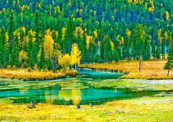
Xinjiang Photography Spots Guide: My Experience on the Ground
I learned most of this the hard way. In 2019 I drove the Duku Highway on a rented BYD, reached the Bayinbuluke overlook at noon, and got flat grey light on the famous nine-bend river. A herder named Tursun laughed and said the water only turns gold in the last hour before dark. He was right. The next evening I waited until 9:20, when the sun finally dropped behind the ridge, and the bends lit up like a circuit board. That lesson runs through everything below: time of day beats gear every single time.
Kanas taught me patience. The lake sits in a basin that fills with fog most mornings until about 8:30. Tour groups arrive by bus at 9, so the only clean window is 7:00 to 8:15 from the Guanyu Pavilion ridge. I paid the extra ¥120 for the boat shuttle to the far shore and had the whole western inlet to myself. The water was mirror-still, and a single log cabin on the opposite bank made the scale obvious. For wider context on that area, my Xinjiang Photography Guide covers filter and lens choices in more depth.
Down south, Karakul Lake changed how I think about foreground. Muztagh Ata rises 7,509 m straight behind the water, but the lake itself is shallow and often wind-blown. On a calm May morning the reflection was so exact I could not tell where the mountain ended. I used a polarizer to cut glare and a 16-35mm to keep both the ice chunks in the foreground and the full peak. A local Kyrgyz family charged me ¥20 to walk their yak pasture trail to the eastern shore, which doubled as a portrait session.
How to Get There
Most readers fly into Urumqi Diwopu International Airport (URC). From there the northern spots are a 1-hour flight or an overnight train to Beitun, then a 4-hour drive to Kanas and Hemu. I usually rent a car in Burqin for the last leg; the road is paved and the ¥300/day SUV fee is worth it for the freedom to stop at Colorful Beach at dusk.
For Sayram Lake and the Ili grasslands, fly to Yining (YIN). A taxi to the lake gate is about ¥120, or rent a car for ¥250/day and loop through Nalati and Karajun. The southern circuit is different: fly to Kashgar (KHG), then it is a 4-hour drive on the G314 to Karakul and White Sand Lake. I hired a driver for ¥600 round trip because the border permit checkpoint at Opal requires the paperwork handled in Kashgar first.
The Duku Highway connects north and south but only opens around June 10 and closes by late September, depending on snow. It is 561 km of switchbacks, and you are not allowed to stop in several tunnel sections. I treat it as a shooting day in itself, not just a transfer.
Best Time to Visit
Spring (Apr-May). The south warms first. Turpan hits the 30s by May, and Karakul Lake is ice-free. Wildflowers start in the Ili valleys but grass is still thin. This is the quietest season and the easiest to get permits without queues.
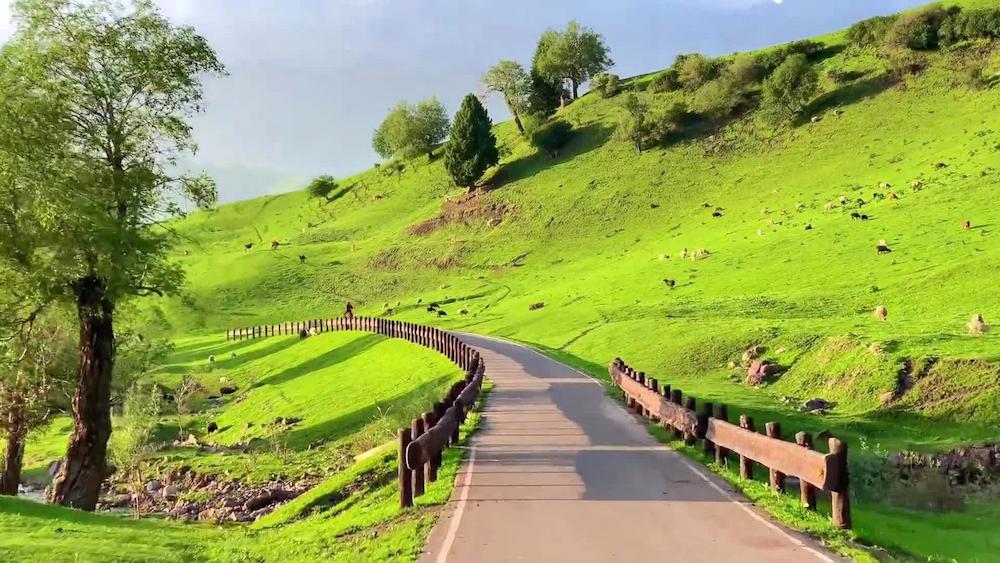
Summer (Jun-Aug). Sayram Lake is at its best in mid-June when the meadows turn purple with gentian. Bayinbuluke and Nalati are green and full of horses. Days are long; the sun sets after 9:30 in the north, giving you two golden hours. Crowds peak in July and August, so shoot at the edges of the day.
Autumn (Sep-Oct). This is my favorite. Kanas and Hemu go gold between roughly September 25 and October 15. Colorful Beach’s mudstone glows red at sunset. Prices for lodging jump, and Hemu guesthouses I booked for ¥180 in May cost ¥520 in October, so reserve early.
Winter (Nov-Mar). Harsh and stunning. Hemu under fresh snow is a postcard, but the Kanas road closes to private cars and you need the park shuttle plus winter tires. I only send confident travelers south in winter; the Pamir passes can shut without warning.
My recommendation: target the last two weeks of September into early October if you want one trip that captures both the golden forests and the last open days of the high roads. Pair it with the seasonal breakdown in our Xinjiang travel guide archive for packing and road-status notes.
Where to Stay
Budget. In Hemu and Kanas, Tuva guesthouses run ¥150-250 in shoulder season and ¥450-600 in October peak. They are basic wood cabins with shared baths, but the location puts you at the platform in five minutes. In Kashgar, the old-city hostels start at ¥90 for a bunk.
Mid-range. The Wyndham in Urumqi (¥480-650) is a reliable base before road trips. In Yining, riverside hotels near the airport run ¥350-450 and include parking. I used the Silk Road hotel in Turpan at ¥320 and could walk to the Grape Valley gate.
Upper. For a treat, the Kanas resort lodges inside the park (¥1,200-1,800) let you skip the shuttle queue and shoot the lake at first light from your balcony. In Kashgar, the restored courtyard hotels in the old city go for ¥900-1,400 and put you steps from the Id Kah Mosque for the pre-dawn blue hour.
Food
You shoot better when you eat well, and Xinjiang makes that easy. In Hemu I had laghman noodles at Ahei’s for ¥25, hand-pulled and topped with a tomato-mutton sauce. Urumqi’s International Grand Bazaar is the easy intro: a full nan flatbread is ¥3, a skewer of lamb (chuanr) runs ¥5-8, and a plate of polo (pilaf with carrot and raisin) is ¥28.
In Kashgar, the Sunday livestock market area sells fresh samsa from tandoor ovens for ¥6 each, and a bowl of uyghur laghman with greens is ¥22. Down in Turpan, the grape season (August-September) means seedless white grapes at ¥8 per kilo at the roadside, and the Grape Valley restaurants serve a cold noodle dish (sengza) for ¥18 that cuts the desert heat. For a full eating plan by region, see our Kanas Lake travel guide, which includes the spots I ate at near the lake.
Practical Tips
- Shoot at the edges of the day. Sunrise and the last hour before sunset beat midday light in every location on this list.
- Carry a polarizer and a neutral-density filter. The glare on Sayram and Karakul will wash out your sky without one.
- Download maps before you leave Urumqi. Signal drops for long stretches on the Duku and the G314 south of Kashgar.
- Pack a second battery and keep it in an inside pocket. At 3,000 m and below freezing, a cold battery dies in minutes.
- Sort your border permit in Kashgar city before driving south. The checkpoints will turn you back without it, and there is no same-day fix.
- Respect private pasture. Ask before stepping onto a family’s land; the ¥20-30 they may ask funds the local school bus.
- Book October lodging six weeks ahead. Hemu and Kanas fill up, and walk-up prices triple.
Sample Itinerary
Day 1. Fly to Urumqi, pick up rental car, overnight at a riverside hotel. Shoot the Red Mountain park at blue hour.
Day 2. Drive to Burqin (about 7 hours), stop at Colorful Beach at sunset. Sleep in Burqin.
Day 3. Morning shuttle to Hemu, shoot the platform at 6 a.m., afternoon walk to the river bend.
Day 4. Transfer to Kanas, boat to the far shore, shoot Guanyu Pavilion ridge at 7:30.
Day 5. Fly to Yining, drive to Sayram Lake, shoot wildflowers and the sunset behind the water.
Day 6. Loop Nalati and Bayinbuluke, wait at the nine-bend river until 9:20 for the gold light.
Day 7. Fly to Kashgar, sort permits, shoot Id Kah Mosque at dawn, drive south to Karakul Lake for the Muztagh Ata reflection.
FAQ
Do I need a drone permit for these spots? Yes for most. Kanas, Bayinbuluke, and the Pamir corridor restrict drones, and you must register with the local police station. I have been fined ¥500 for launching without a note, so register first.
What is the single best month for a first trip? Early October. You get the golden forests of the north and the last open window on the high roads before winter closure.
Can I do this without renting a car? Partly. Buses reach Urumqi, Kashgar, and Yining, and park shuttles cover the gates. But the Duku and the Pamir loop are far easier with a driver, which I booked for around ¥600 per day in the south.
How cold does it get at the lakes? Hemu dropped to minus 4 in early October when I was there, and Karakul sits near freezing even in May. Bring a real down jacket; the wind at 3,600 m cuts through a fleece.
Is it safe to shoot alone at dawn? In the villages and parks, yes. On remote Pamir stretches, I travel with a driver and tell the guesthouse my plan. Mobile coverage is thin, so a satellite messenger is cheap insurance.
Disclaimer
Entry fees, permit rules, shuttle prices, and road-open dates in this Xinjiang Photography Spots Guide are based on my trips between 2018 and 2025 and change often. The ¥ figures above are typical amounts I personally paid, not guaranteed rates. Border permits, park shuttle costs, and the Duku Highway opening date shift year to year with snow and policy. Always confirm current prices and access with the official park offices or a licensed Xinjiang operator before you travel, and check the latest best time to visit Xinjiang notes for road status.