

Everyone has heard of the Duku Highway, but the best scenic drives in Xinjiang go well beyond that single road. This region packs deserts, snow peaks, and high plateaus into routes where the driving itself is the attraction. Over eight seasons on the road here, I’ve run most of them, and the ones below are the drives I send clients back for. Each comes with its length, the season it opens, the highlights, and whether you’ll need a permit — so you can match a road to your dates and interests rather than arriving to a closed gate.
Duku Highway (独库公路)
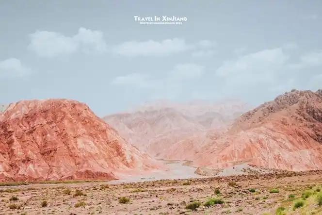
The Duku Highway is the headline act for good reason. At about 561 km, it crosses the Tianshan mountains from north to south, linking Dushanzi (near Karamay) to Kuqa in the Tarim Basin. In a single day you climb through spruce forests, alpine meadows, and snow tunnels near the summit, then drop into red-rock canyon country. It’s one of the few roads on earth where you can start in subalpine forest and finish in desert within a few hours.
- Length: ~561 km
- Season: typically open ~June 1 to October 10, weather permitting; closed in winter by snow.
- Highlights: Tianshan Grand Canyon, Bayinbuluke grasslands, the Hashila Gen tunnel area, and constant mountain drama.
- Permit: none for the highway itself, but you’ll pass checkpoints — carry your passport.
It’s the classic self-drive-or-driver route and the centerpiece of many north–south loops. For the full planning detail, see our Duku Highway road trip guide.
Tarim Desert Highway (塔里木沙漠公路)
The Tarim Desert Highway runs roughly 520 km from Luntai to Hotan, cutting straight through the Taklamakan — China’s largest desert and one of the largest shifting-sand deserts on the planet. The road is flanked by a thin green belt of irrigated desert shrubs, a remarkable anti-aeolian planting effort. It’s eerily quiet and very straight; the highlight is the emptiness itself, plus the contrast when you finally reach oasis towns.
- Length: ~520 km (Luntai–Hotan)
- Season: open year-round, though summer heat is extreme (often 40°C+).
- Highlights: Taklamakan dunes, desert fringe villages, the sense of crossing a true sea of sand.
- Permit: none, but fuel up and carry water — services are sparse.
G219 Xinjiang–Tibet Highway (新藏公路)
The G219 from Yecheng (Kargilik) to Tibet is the most demanding drive on this list — and one of the highest paved roads in the world, cresting passes above 5,000 m. It’s an epic for seasoned travelers only. The air is thin, the towns are few, and altitude sickness is a real risk. The scenery — vast Tibetan Plateau, remote lakes, and army outposts — is unforgettable, but this is not a casual day trip.
- Length: the Yecheng–Tibet stretch is roughly 2,100+ km to Lhasa; the Xinjiang portion to the border area is several hundred km.
- Season: best June–September; high passes snowed in otherwise.
- Highlights: high-altitude plateau, Karakul-type landscapes, true frontier isolation.
- Permit: required — both a Tibet travel permit and, for foreigners, strict restrictions. Most foreigners cannot freely self-drive this; check current rules and go with an approved operator.
Panlong Ancient Road (盘龙古道)
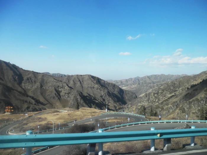
Near Tashkurgan in the far south, the Panlong Ancient Road is a short but spectacular switchback climb — about 75 km of hairpin after hairpin winding up and over a ridge. Its local tagline translates to “the road with 600 bends.” It’s become a must for drone photographers. Pair it with the Karakoram Highway since they’re in the same corner of the Pamirs.
- Length: ~75 km
- Season: roughly May–October; snow closes it in winter.
- Highlights: 600+ switchbacks, panoramic Pamir views, drone footage gold.
- Permit: the Tashkurgan border permit is required (see below).
Karakoram Highway (喀喇昆仑公路 / KKH)
The Karakoram Highway runs from Kashgar to Tashkurgan and on toward the Khunjerab Pass on the Pakistan border. It follows the old Silk Road over high passes, past the white pyramid of Muztagh Ata and the blue finger of Karakul Lake. This is the drive that puts you on the roof of the world.
- Length: Kashgar–Tashkurgan ~300 km; onward to Khunjerab adds ~130 km.
- Season: May–October is reliable; the Khunjerab Pass closes in deep winter.
- Highlights: Karakul Lake, Muztagh Ata, the Pamir plateau, border-region culture.
- Permit: a border permit for Tashkurgan County is required for foreigners; arrange it in Kashgar.
Guozigou (果子沟)
Guozigou is a shorter, gentler drive through a forested gorge between the Ili Valley and Sayram Lake in the far west. The Guozigou Bridge — a soaring cable-stayed span — is an attraction in its own right. It’s an easy half-day between Yining and Sayram Lake, best in late spring and summer when the valley greens up.
- Length: the gorge section is ~30 km; part of the Yining–Sayram corridor.
- Season: open year-round; lush May–September.
- Highlights: Guozigou Bridge, forested canyon, gateway to Sayram Lake.
- Permit: none.
S21 Desert Highway (S21 沙漠公路)
The S21 is a newer expressway linking Urumqi directly to Altay in the north, slicing across the Gurbantünggüt Desert. It cuts a former 8–10 hour haul down to about 4–5 hours, opening the Kanas region for people flying into Urumqi. It’s a fast, smooth desert run rather than a scenic switchback, but it makes the north far more accessible.
- Length: ~340 km (Urumqi–Altay)
- Season: open year-round; winter brings snow and ice caution.
- Highlights: desert expressway, fast access to Kanas and Hemu.
- Permit: none.
Scenic Drive Comparison Table
| Drive | Length | Best Season | Permit Needed? | Difficulty |
|---|---|---|---|---|
| Duku Highway | ~561 km | Jun 1 – Oct 10 | No (checkpoints yes) | Moderate |
| Tarim Desert Hwy | ~520 km | Year-round (avoid peak heat) | No | Easy–Moderate |
| G219 Xinjiang–Tibet | 700+ km in Xinjiang | Jun – Sep | Yes (strict) | Hard |
| Panlong Ancient Rd | ~75 km | May – Oct | Border permit | Moderate |
| Karakoram Hwy | ~300 km to Tashkurgan | May – Oct | Border permit | Moderate |
| Guozigou | ~30 km gorge | Year-round | No | Easy |
| S21 Desert Hwy | ~340 km | Year-round | No | Easy |
Putting the Drives Together: Sample Routes
These roads rarely stand alone — they combine into unforgettable loops. Two I recommend often:
- North classic (5–7 days): Urumqi → S21 Desert Highway to Altay → Kanas and Hemu → back via the Duku Highway south to Kuqa. Combines fast desert highway with mountain drama.
- South Pamir run (3–4 days): Kashgar → Karakoram Highway to Tashkurgan → Panlong Ancient Road switchbacks → Karakul Lake → return. Best in September–October with the border permit sorted in Kashgar.
For a desert-and-canyon contrast, add the Tarim Desert Highway as a one-way crossing from Luntai to Hotan, then fly or train onward. The Duku remains the spine that makes a north–south crossing possible in a single day. Whichever loop you choose, build in a buffer day — weather and the occasional road closure are part of traveling this far west, and a relaxed schedule is what turns a good drive into a great one.
Which Vehicle for Which Road
- Sedan/SUV: fine for the Duku, S21, Guozigou, and Tarim — all paved and maintained.
- 4WD SUV: better for the Pamirs (Karakoram, Panlong) where roads are rougher and weather turns fast.
- High-clearance not required on the main routes, but a confident local driver matters more than the vehicle on mountain passes.
Most foreign travelers do these with a hired driver rather than self-drive. Our driver guide breaks down the daily cost so you can budget the whole loop.
Seasonal Driving Calendar
| Month | What’s Open | What’s Closed / Risky |
|---|---|---|
| May | Karakoram, Guozigou, S21 | Pamir permits just opening; some passes snowy |
| Jun – Aug | Duku, Panlong, Tarim, all main routes | Crowds and peak prices; afternoon desert heat |
| Sep – Oct | Duku (to ~Oct 10), Pamirs, Tarim | Best light; Duku closes mid-October |
| Nov – Apr | S21, Guozigou (with caution) | Duku, Panlong, Karakoram, G219 closed by snow |
Plan your drive around this calendar. The single biggest disappointment I see is travelers arriving in November expecting the Duku Highway — it’s been snow-closed for weeks. If you’re set on a specific road, build the trip dates around its season, not the other way around.
Planning Notes for Drivers
- Most of these need a driver, not self-drive. Foreign travelers typically hire a licensed local driver (see our guide on Xinjiang travel guide for costs).
- Checkpoints are normal. Carry your passport everywhere; border-area drives require the Tashkurgan permit, arranged in Kashgar.
- Time your season. The Duku, Panlong, and Karakoram routes close or degrade in winter. Build flexibility around weather.
- Fuel and water. Desert routes (Tarim, S21) have sparse services — top up whenever you can, and carry a day’s water per person.
- Download offline maps. Signal drops on mountain and desert stretches; a saved route keeps you oriented when the driver’s navigation loses service.
- Start early. Long drives and afternoon desert heat favor dawn departures; you’ll also catch the best light at the viewpoints.
For the broader list of places these roads reach, browse our Xinjiang attractions pages, and if you’re deciding between regions, our Xinjiang cities guide helps you anchor a start and end point.
Frequently Asked Questions
Which Xinjiang drive is best for first-timers?
The Duku Highway. It’s the most famous, well-maintained, and packed with variety in a single day. Go with a driver in summer when it’s open.
Do I need a permit for the Duku Highway?
No special travel permit, but you’ll pass police checkpoints where you must show your passport. The road itself is open to all domestic and foreign travelers during its season.
Can foreigners drive the G219 to Tibet?
Not freely. The Xinjiang–Tibet G219 involves strict permits and restrictions for foreign travelers. Most attempt it only through an approved operator, and even then rules change — verify before planning.
What’s the Panlong Ancient Road famous for?
About 75 km of continuous switchbacks — locally “600 bends” — near Tashkurgan. It’s a short, dramatic climb beloved by drone photographers, paired with the Karakoram Highway.
Is the Tarim Desert Highway safe to drive?
Yes, it’s a paved, maintained road, but it’s remote. Fuel up, carry water, and don’t rely on frequent services. Summer heat is intense.
When do the mountain roads open?
The Duku Highway typically opens around June 1 and closes by October 10. Panlong and the Karakoram Highway run roughly May to October. Winter closes the high passes.