

Planning a 14-Day Xinjiang Itinerary is the sweet spot for most travellers who want to see the region without spending a month on the road. In my eight seasons guiding trips here, I have found that two weeks lets you cover the north’s lakes and grasslands plus a slice of the south, if you keep the driving sane. Xinjiang is enormous — about 1.6 million square kilometres, a sixth of China’s land area — so a loop, not a straight line, is the efficient way to use your time. This route starts and ends in Urumqi and runs clockwise through the Altai mountains, the Ili valley, the Tianshan spine via the Duku Highway, and down into the Tarim basin.
I tell clients to treat the plan below as a backbone, not a contract. Weather closes mountain passes, hotels sell out in July and August, and you will want a buffer day. A full Xinjiang itinerary that tries to add Hotan and the far west in fourteen days becomes a bus tour on wheels. Keep it to the loop, and you will actually remember the places you visited.
Why fourteen days works
Xinjiang punishes tight schedules. Distances are measured in half-days, not hours, and the highlights are scattered across three mountain systems. Two weeks gives you roughly ten travel days and four slower days for the places that deserve them: Kanas, Hemu, Sayram Lake and the Duku Highway. Anything under ten days and I steer people to North Xinjiang only. Anything over eighteen and you can add Kashgar and the Pamir. Fourteen sits right at the point where the loop closes comfortably.
The loop below avoids backtracking. You head north to the Altai, swing west to Ili, cross the Tianshan south on the Duku Highway, then return east along the northern Tarim edge and up through Turpan. Total driving is around 3,000 kilometres, almost all on good asphalt with one serious mountain road.
The day-by-day 14-day loop
| Day | Route | Drive time | Overnight |
|---|---|---|---|
| 1 | Arrive Urumqi, acclimatise, museum & bazaar | — | Urumqi |
| 2 | Urumqi → Tianchi (Heavenly Lake) → Urumqi | 1.5 h each way | Urumqi |
| 3 | Urumqi → Urho Ghost City → Karamay | ~4 h | Karamay |
| 4 | Karamay → Burqin (via Colorful Beach at sunset) | ~4 h | Burqin |
| 5 | Burqin → Kanas Lake | ~2.5 h | Kanas |
| 6 | Kanas → Hemu village | ~1 h | Hemu |
| 7 | Hemu → Koktokay (Keketuohai) | ~4.5 h | Koktokay |
| 8 | Koktokay → Karamay | ~4 h | Karamay |
| 9 | Karamay → Sayram Lake | ~5 h | Sayram Lake |
| 10 | Sayram Lake → Yining (Ili) | ~2 h | Yining |
| 11 | Yining → Nalati or Karajun grassland | ~3 h | Nalati |
| 12 | Nalati → Bayinbulak → Duku Highway → north | ~6 h | South of Tianshan |
| 13 | Kuqa → Tarim desert highway → Turpan | ~7 h | Turpan |
| 14 | Turpan → Urumqi, depart | ~2.5 h | — |
This is a full but fair pace. Days 12 and 13 are the longest drives; I build buffer into them by starting early. If you prefer a gentler trip, drop Turpan on day 13 and fly out from Kuqa or Yining instead.
North Xinjiang: Altai and the lakes
The first week is the part most travellers remember. Tianchi, the “Heavenly Lake,” sits at about 1,900 metres in the Bogda range, 110 kilometres from Urumqi. A cable car and boardwalks get you to the water; go early to beat the coach crowds. Urho Ghost City is a wind-eroded yardang landscape 300 kilometres northwest — the rock shapes justify the detour, and the late-afternoon light is best.
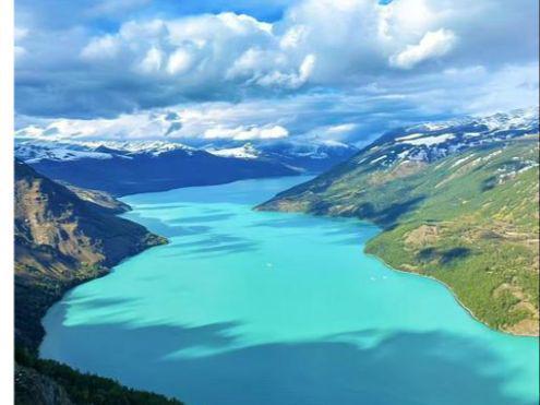
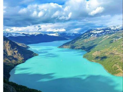
Burqin is your base for the Altai. From there Kanas Lake is another two and a half hours on a slow, scenic road. Kanas is the headline: a glacial lake at roughly 1,300 metres ringed by conifers and, in late September, golden larches. I always tell people to stay inside the scenic area (at Kanas village or Hemu) rather than commuting from Burqin — the morning mist and evening calm are the real show, and day-trippers miss both. Hemu is the smaller, prettier sibling, a wooden Tuva village in a river valley. Koktokay, two ranges east, has granite peaks, autumn birch, and the Irtysh River headwaters; it is quieter and a good place to break the long drive back toward the highway.
Ili and the grasslands
Crossing into the Ili valley changes the scenery from alpine forest to rolling pasture. Sayram Lake, at 2,071 metres, is the largest alpine lake in Xinjiang and often the windiest place on the trip — bring a shell jacket even in summer. Stay in a yurt or the lakeside hotel and watch the water turn silver at dusk.
Yining (Ghulja) is the valley’s hub and a good food town — try the hand-pulled laghman and the night-market kebabs. From here both Nalati and Karajun grasslands are reachable. Nalati, at around 1,800 metres in Xinyuan county, is the more developed of the two, with cable cars and a driving loop; Karajun, near Tekes, is wilder and better for hiking. Pick one. Seeing both eats a day you can spend elsewhere. My Xinjiang travel guide covers the trade-offs in detail, but for a first 14-day loop, Nalati is the easier choice.
The Duku Highway and the Tianshan crossing
The Duku Highway is the single best drive in the region and the reason this loop closes so neatly. The road runs 561 kilometres from Dushanzi to Kuqa and crosses the Tianshan at over 3,400 metres, dropping you from snow-line meadows into red-rock desert in a single day. It is only open roughly June to early October, and closes for the winter — never plan a trip that depends on it outside that window.
I route day 12 as Bayinbulak grassland to the Duku crossing and down toward Kuqa. Bayinbulak, at about 2,500 metres, has the Kaidu River’s nine bends and a large swan reserve; it is cold at night even in July. The Duku itself has several pull-offs at alpine lakes (Dalongpool, Xiaolongpool) and a high pass with snow banks in June. Drive it with a local driver if you can — the road is narrow, cliff-edged in places, and the weather turns fast. Full planning detail is in our Duku Highway road trip guide.
South into the Tarim and back
From Kuqa you reach the southern edge of the Tarim basin. Kuqa itself has the Kizil caves (the oldest Buddhist murals in Xinjiang) and a relaxed old town. Day 13’s desert-highway run to Turpan is long but flat; the Tarim Desert Highway is a straight shot through endless dunes. Turpan, at 150 metres below sea level, is the contrast: the Flaming Mountains, the Jiaohe ruins, and the grape valleys. It is also the hottest place in China in summer, so time outdoor stops for early morning or evening. From Turpan it is a short hop back to Urumqi to catch your flight.
Best season for this loop
If I had one sentence of advice it would be: come in September. The larches around Kanas turn gold, the Ili grasslands are still green but the crowds are gone, the Duku is open and the desert heat has eased. June and July bring the grassland wildflowers and the most reliable weather, but also the peak crush and the highest hotel prices. August is hot in the south. Winter closes the Duku and buries the Altai passes; skip this loop then.
Practical tips I give every client
- Hire a driver. Self-driving is legal but the distances, checkpoints, and permit desks make a local driver worth the RMB 800–1,200 per day. You see more and argue with fewer officials.
- Book peak-season hotels early. Kanas, Hemu, Sayram and Bayinbulak have limited rooms and sell out weeks ahead in July–August. Pay the premium for in-scenic-area stays.
- Build buffer days. One weather or illness day in fourteen is normal. Keep days 8 and 13 flexible.
- Carry your passport always. There are police checkpoints on most inter-city roads; you will show ID daily.
- Pace the altitude. Nothing here is extreme, but Bayinbulak and the Duku pass are over 2,500 metres. Sleep low when you can.
Extending to the Pamir (if you add days)
The loop above stops short of Kashgar and the Pamir Plateau. If you want Tashkurgan and the Karakoram Highway, add four to five days at the end: fly or drive Kuqa → Kashgar, then take the border road south. You will need a Border Permit (边境管理区通行证) for Tashkurgan county, issued in Kashgar with your passport — allow a morning for it, and acclimatise in Kashgar (1,300 m) before climbing to Tashkurgan (3,000 m+) and the Khunjerab Pass area. I keep this off the 14-day plan because it pushes the driving past the point of enjoyment; it belongs on a 21-day route.
For more destination detail across the region, browse our Xinjiang attractions pages, and for city-by-city logistics see the Xinjiang cities guides.
What to pack for the 14-day loop
The loop crosses three climate zones, so pack in layers. A waterproof shell is essential — Sayram Lake and the Duku pass are windy and can turn cold or wet without warning even in July. Good walking shoes matter at Kanas, Hemu and the grasslands; you will do real trails, not paved paths. Sun protection (hat, sunglasses, SPF) is non-negotiable at altitude and in the desert south. Bring a refillable bottle, any personal medication (small-town pharmacies rarely stock Western brands), and a power bank — long drive days drain phones used for maps and translation. Cash helps at remote stalls; carry RMB 500–1,000 in small notes alongside Alipay or WeChat Pay. Finally, a passport photocopy and offline maps downloaded before you lose signal on the mountain roads will save a bad afternoon.
Frequently asked questions
Is fourteen days enough for Xinjiang?
Yes for a first loop. It covers the north’s signature lakes and grasslands plus the Duku crossing and a taste of the south. You will not see Kashgar or the Pamir, but you will see the places most travellers come for. Add a week if you want the far west.
Can I do this route by train or bus?
Partly. Trains reach Urumqi, Karamay, Yining and Turpan, but Kanas, Hemu, Sayram, Bayinbulak and the Duku Highway are not served by rail. A hired car or a small-group tour is the realistic way to run the loop.
When does the Duku Highway open?
Usually early June to early October, depending on snow. It is closed completely in winter. Never book non-refundable hotels on either end of the Duku outside that window.
Do I need a visa or any special permit?
A standard China tourist visa covers Xinjiang. No special permit is needed for this loop. Only the Pamir extension (Tashkurgan) requires a Border Permit, obtained in Kashgar.
How much should I budget per day?
With a driver and mid-range hotels, plan RMB 900–1,500 per person per day in peak season, more for the scarce in-scenic-area rooms at Kanas and Sayram. Food and entries are cheap; transport and rooms dominate the cost.
Is the food a problem for vegetarians?
Central Asian and Uyghur cooking leans on meat, but laghman noodles, naan, polu (without meat on request), and vegetable stir-fries are available. In bigger towns like Urumqi and Yining you will find Han Chinese options too.